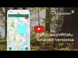
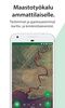

Karttaselain - Maastokartta is a versatile mapping application designed to serve navigational needs with a suite of comprehensive map-related functionalities. Whether exploring the vast terrain or navigating city streets, the application provides users with free access to the most precise and current topographic maps, city maps, aerial imagery, and basic property information for a well-informed and enriched outdoor experience.
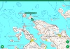
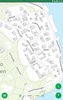
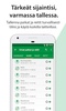
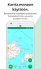
Free features include detailed and up-to-date topographic maps from the National Land Survey, an array of outdoor resources such as shelters and trails, complete aerial imagery covering Finland, and urban maps with streets clearly labeled. Norway's stunning topographical maps and basic depth contours for smaller lakes are directly built into this platform. Property maps showcasing parcel boundaries and identifiers are periodically updated from the property registry, giving users a fundamental understanding of the land layout. Essential to navigation, GPS functionality presents users' precise location, tracks movement, and displays speed (requiring a device with a GPS receiver).
The plus subscription enhances the experience even more. With it, users gain access to comprehensive depth charts ideal for boating and fishing, based on the Transport Agency's nautical database, the most accurate nautical charts, and continuously updated detailed property information including area size and property search features. Additional perks include shaded relief maps, forest orthophotos, secure cloud storage of waypoints and routes, and synchronization between web and mobile versions for seamless transition. Offline map use, meticulously planned routes, and area calculations of drawn shapes add significant value.
The option for location tracking includes dog GPS and personal or vehicle tracking, adding a layer of safety and utility for activities like hunting, which is complemented by the 'My hunting areas' feature. Measurement tools allow users to determine the area of the path they've traveled, adding depth to their outdoor pursuits.
With a 14-day free trial of the Plus features, an opportunity is provided to explore the full offerings before deciding on a subscription, available at €9.99 for two months or €39.99 for a year, supporting use on up to four devices. For teams requiring a more expansive solution, consider the business license available on the application's website.
Engage with the community through social media platforms or by providing feedback on app stores, and for any inquiries, expert customer service is available on the website. Karttaselain - Maastokartta remains a top choice for those seeking a robust and detailed mapping solution.
Requirements (Latest version)
- Android 5.0 or higher required
Comments
There are no opinions about Karttaselain - Maastokartta yet. Be the first! Comment